
Well… The rain appears to have left the forecast, the southern-most section of the Washington PCT appears to be mostly clear of snow, and I’m free until I start a new job on Monday. 
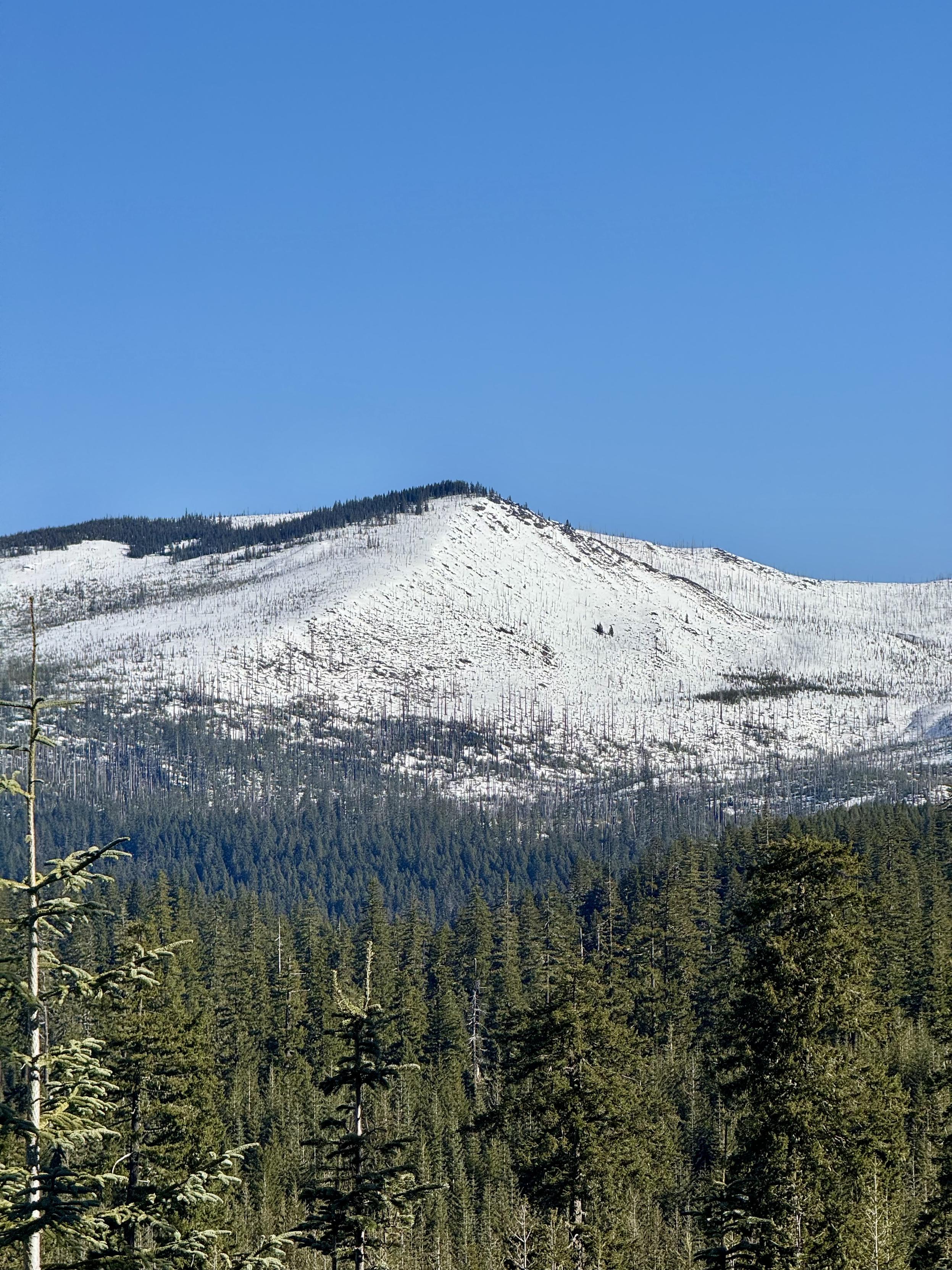
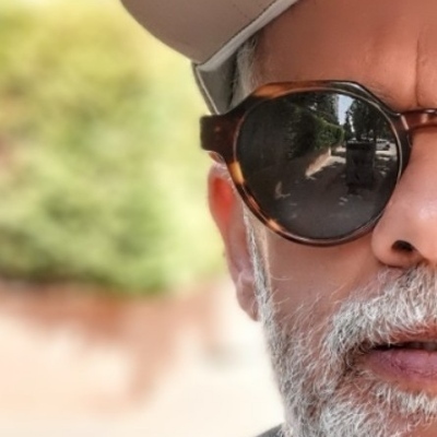
I was looking at this mountain yesterday on the map and thought, “I wonder if I can summit this?” After six hours of hiking this morning I can finally see the approach. I’m in the Columbia River Gorge. Which mountain is this? I started at sea level to get this far. You have until I reach the summit to guess!
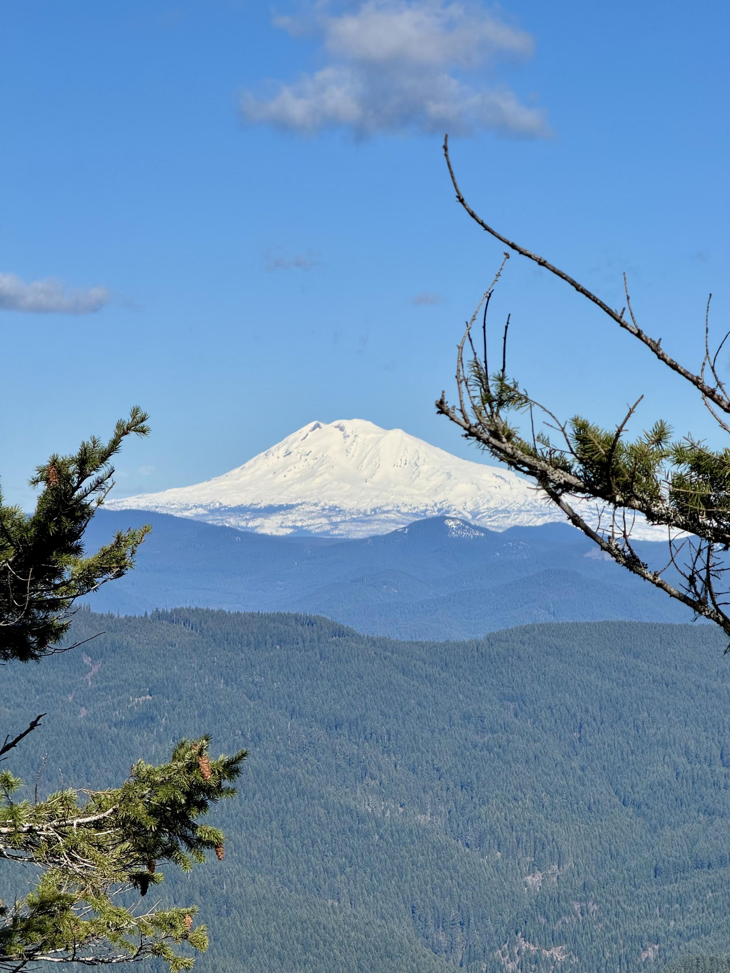
Nice partially obstructed view of Mount Adams on the summit of Greenleaf Peak. Time to get out of the wind and find a place to camp.
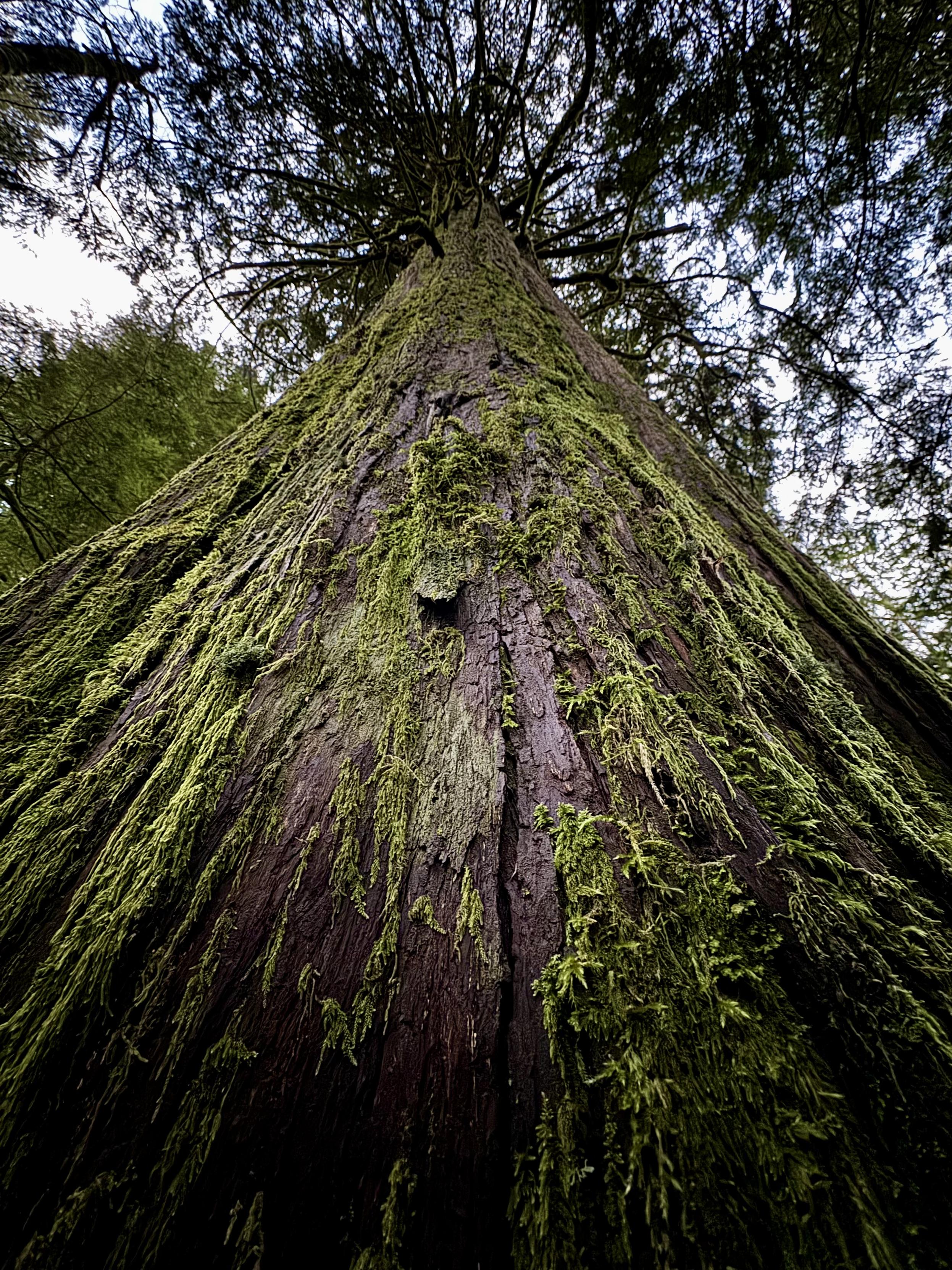
After leaving the peak, I went looking for an ancient cedar grove on the plateau between Greenleaf Peak and Table Mountain. I lost steam last night but I found them this morning at first light. Head down the abandoned road southwest of Greenleaf Peak and you can’t miss them when you arrive at the first creek.
@andrewbriscoe
I have no idea which mountain, but so impressive that your hike started at sea level! Have a great rest of your hike!
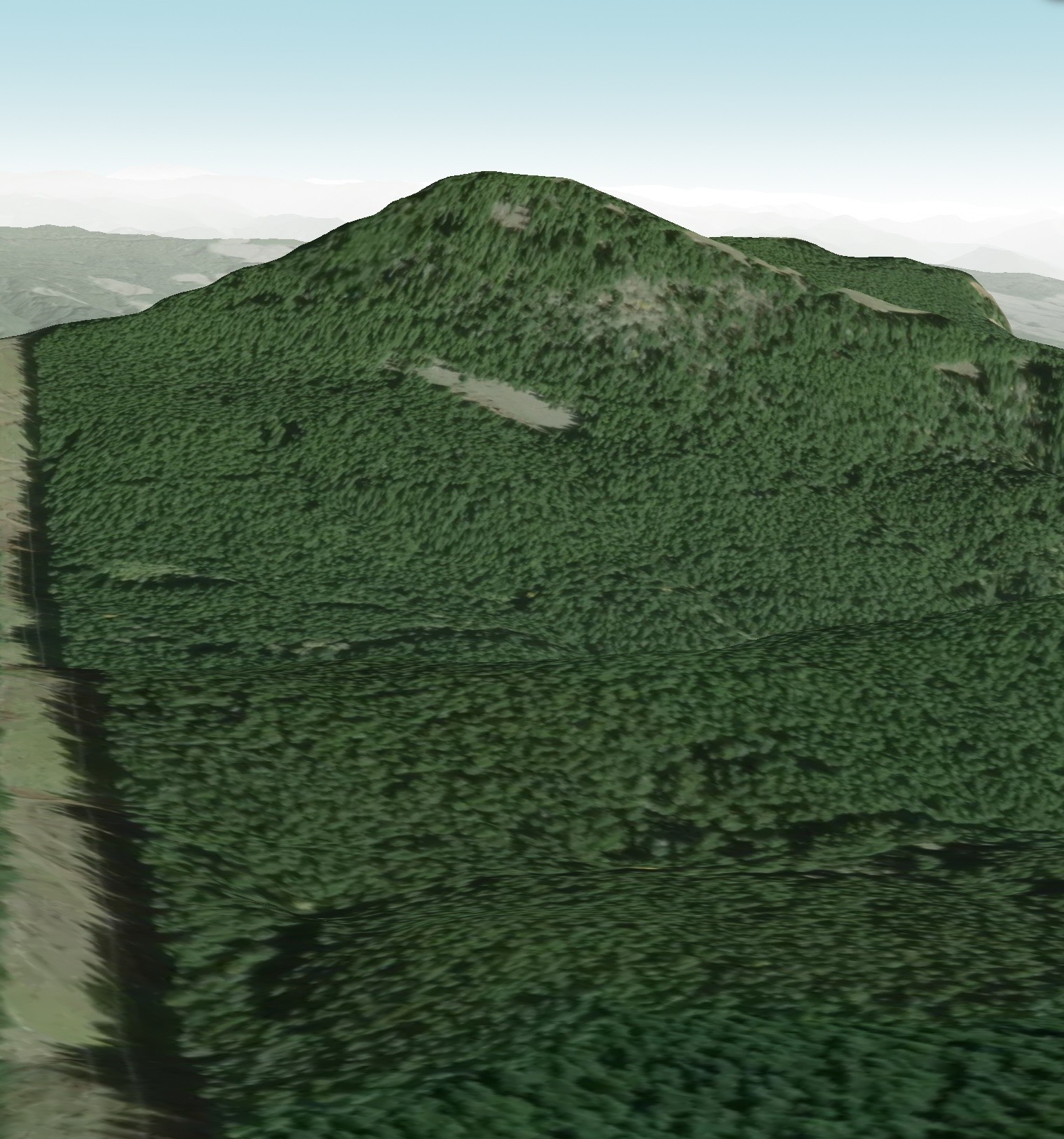
@rreusser Bingo. Good job!
@andrewbriscoe I bet you're looking at Greenleaf peak. NE of Table Mountain. Tops out about 3400'. If so, I think you wanna approach from the SW. The other side looks pretty dicy.
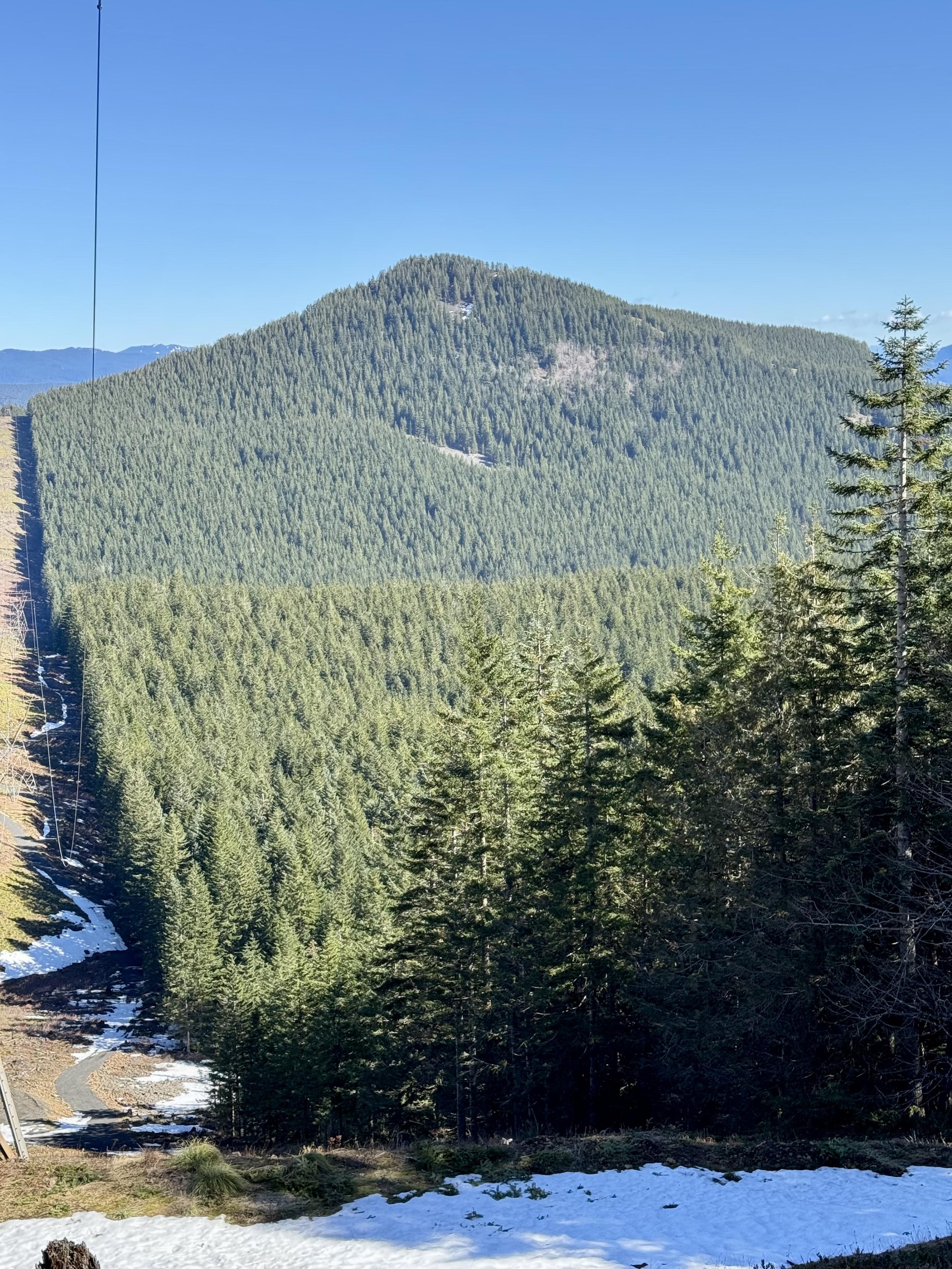
Birkenfeld to the west also looks interesting. ~3700'. I bet there's a boot track to the summit from the PCT.

@intrepidhero Nevermind! 
@intrepidhero Was probably going to round that in the morning. Will check it out. Thanks!
@andrewbriscoe The PCT crosses a saddle south of Birkenfeld at about 3400'. Seems like when I went through there the terrain was looking kinda alpine. I remember thinking it looked like a cool spot to explore. The topo looks like you could probably ascend the ridge that rises NW from the saddle.
Stay safe and enjoy!
@intrepidhero Thanks! I will be careful.
@intrepidhero Definitely doable from that point. I got up on the ridge and determined a low avalanche risk wasn’t worth it.
@andrewbriscoe Nice! Good to know.
@intrepidhero You got it! By luck I headed in from the west. There is snow covering the power line road on the east. Just made it to the top with minimal snow. What does Birkenfeld look like on a topo map? I don’t see it on mine.
@andrewbriscoe Nice job! How much of a bushwack was it? Any views from the top?
@intrepidhero Just posted the view of Adams. There are three rocks on deadfall at the saddle of the power line road. A few bits of flagging tape lead to an old abandoned trail. Seems like there was a lookout up here that was toppled in the winter of 07 or 08.
@andrewbriscoe Neat! sounds like you're having a good adventure.
@andrewbriscoe
What a beautiful view! I'm jealous! Hope you can stay warm camping.
@TimKStanton Thank you! I’m wearing many layers in my 15 degree bag so warm now. 
@andrewbriscoe @TimKStanton
That's the way to do it. Enjoy!!


@andrewbriscoe That's an astonishing sighting! 

@andrewbriscoe Wow, look at that snow cap. 
@andrewbriscoe That's cool! I didn't know about these.


@andrewbriscoe phew – beautiful!