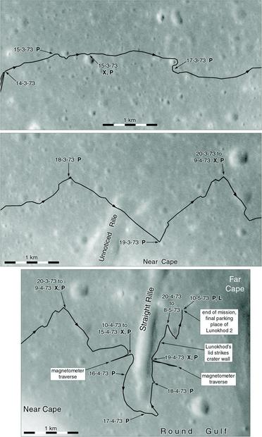
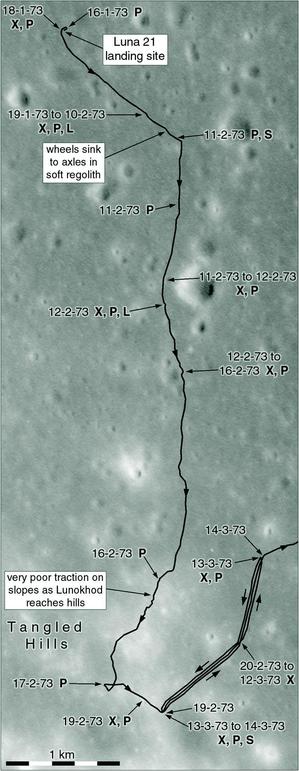
This is the rest of the Lunokhod 2 map as it was published in 2007, in three sections. The letters signify different experiments, but we will see more of that later. The problem with the map is the way the line is placed on the base map. Then its position could only be guessed, now we can actually see the tracks. Also, as we are going to see, many fine details are omitted here.
#luna21
Putting all this together - a base of Apollo 15 images, the Russian maps and location data - I made the maps which appeared in my old lunar exploration atlas. Here they are over two posts. This was the best that could be done at the time. Unfortunately I added some other details which were catastrophically wrong. But let's just enjoy these maps for the time being...
#maps #moon #luna21 #lunokhod2
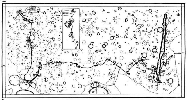
I didn't find it myself - it was sent by a friend. But the rest of the map has not been published, or if it has, I don't know where. Luckily my friend (hired personally by Sergei Pavlovich, and in those circles a last name is not necessary) sent me this scan, which is just barely legible but does allow a new map to be labelled. The hoops we have to jump through! I'm dealing with the same things now with China's Yutu-2 rover.
#maps #moon #luna21 #lunokhod2
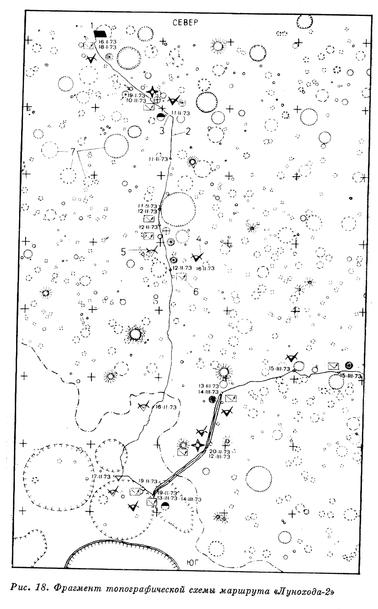
I have mapped every rover journey on the Moon and Mars, and I don't just want a wiggly line. I want to be able to say 'the rover was here on --- date', and 'here the rover made this observation'. That line on the MIIGAiK map is not enough. Luckily a map with that information was compiled, but it's hard to find. The part attached here was published in:
Vernov, S. N., ed., 1978. Uspekhi Sovetskogo Soyuza v issledovanii kosmicheskogo prostranstva. Moscow: Nauka.
Here:
https://planetarymapping.elte.hu/lunokhod-2-traverse-map/
is a map of the Luna 21 - Lunokhod 2 area in Le Monnier crater, published in 1973 by MIIGAiK, now known as the Moscow State University of Geodesy and Cartography. The path is overlaid as well as could be estimated at the time. Red circles along the route are lunar night stops. Curiously, the second night stop at lower left is in the wrong place, as we will see. One section was driven 3 times. #maps #moon #luna21 #lunokhod2
Apollo Panoramic Camera images are not as high resolution as LRO's Narrow Angle Camera images, but they are pretty good. However, this area was quite far north of the Apollo 15 orbit and was only seen obliquely at a greater distance than the point below the spacecraft. They did show the major features of the landscape: that linear valley, the main hills around he site. But the exact rover path could not be traced very well. Next we will look at earlier attempts. #moon #luna21 #lunokhod2
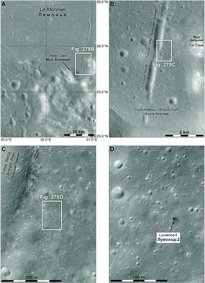
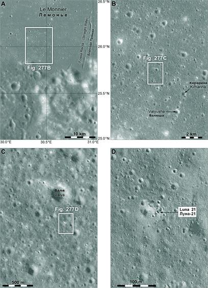
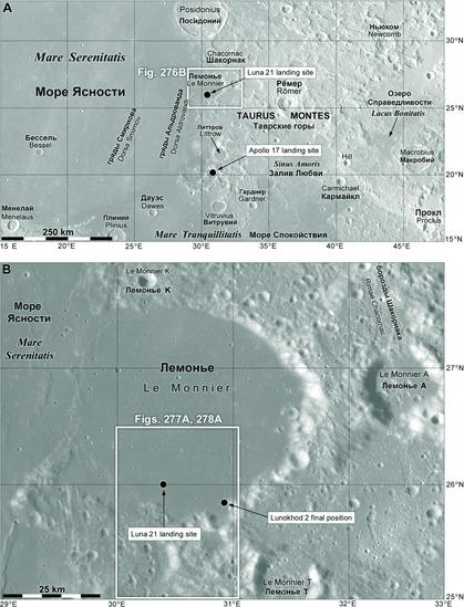
Here is another of my zoom-in sequences locating Lunokhod 2. We know this now because of LRO and its amazing images. But before LRO - that's a gap of 36 years - the exact location was not known very well. The story is similar to that of Lunokhod 1: we had a map showing craters along the route but most features were too small to show up on the best images. This time the best images were from Apollo 15's Panoramic Camera... #maps #moon #Luna21 #lunokhod2
Craters at the Lunokhod 1 site were named after men associated with the mission, first names in diminutive form. They were not used at the time of the mission but were put on a modern map and accepted by the IAU. These Lunokhod 2 names are women, probably people connected with the mission - a few are obvious to anyone who knows the people. They were proposed to the IAU quite a few years ago but nothing happened. Male bias? Probably. #moon #luna21 #lunokhod2
Zooming in on Luna 21, here it is with tracks visible in the last image. There are a few feature names here - all of them unofficial except the name of the crater, Le Monnier. The Soviets did not name craters and other features at their sites until this mission, where a few names were given at the time, including 'Straight Rille', a linear valley. Crater names came only recently, all diminutives of womens' names. We will see a few more later. #maps #moon #luna21 #lunokhod2
I am still pondering Luna 20's images but for now we will look at the next Soviet mission to land on the Moon, Luna 21. It flew only a few weeks after Apollo 17 ended NASA's lunar exploration program, and for a few years the Soviet Union had the Moon to itself. Luna 17's rover had seen a few distant hills but Luna 21's rover, Lunokhod 2, would visit the boundary between plains and mountains in the most scenic place any Luna lander visited. #moon #luna21 #lunokhod2
#σημερα είναι #babinden σε #russia και #belarus, ημέρα παιδιών στην #thailand και #WorldTypingDay.
#σανΣημερα το 1297 ο #FrançoisGrimaldi μεταμφιεσμένος σε μοναχό, καταλαμβάνει το #monaco.
Το 1454 ο Παπάς αναγνωρίζει στους Πορτογάλους αποκλειστικά εμπορικά δικαιώματα με την #africa, νότια του #capeBojador.
Το 1973 η σοβιετική αποστολή #luna21 εκτοξεύεται.
Το 1981 πραγματοποιείται η καλύτερη καταγεγραμμένη θέαση #ufo στην περιοχή #TransenProvence της #france.
(Συνεχίζεται)


